USGS Releases Unified Geological Map of the Moon
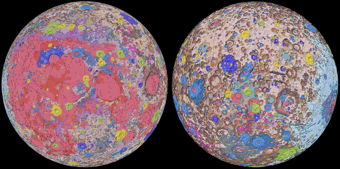
Orthographic projections of the "Unified Geologic Map of the Moon" showing the geology of the Moon’s near side (left) and far side (right) with shaded topography from the Lunar Orbiter Laser Altimeter (LOLA). This geologic map is a synthesis of six Apollo-era regional geologic maps, updated based on data from recent satellite missions. It will serve as a reference for lunar science and future human missions to the Moon. Credit: NASA/GSFC/USGS.
The USGS Astrogeology Science Center, in collaboration with NASA and the Lunar Planetary Institute has mapped the entire lunar surface. Called the “Unified Geologic Map of the Moon,” the project serves as the definitive survey of the moon’s surface geology for future human missions and will be invaluable for the scientific community, educators, and the general public. The digital map is available online now and shows the moon’s geology in incredible detail (1:5,000,000 scale).
“People have always been fascinated by the moon and when we might return,” said current USGS Director and former NASA astronaut Jim Reilly. “So, it’s wonderful to see USGS create a resource that can help NASA with their planning for future missions.”
For more details about the map, read the abstract or download it directly at the Unified Geologic Map of the Moon website.
USGS provides science for a changing world. For more information, visit www.usgs.gov.
Subscribe to USGS News Releases via our electronic mailing list or RSS feed.